
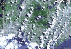
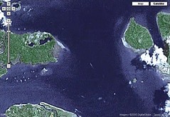
location of e cat's house ~26 years ago:
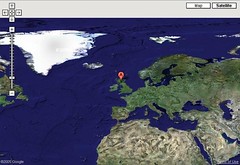
kinda near Iceland & Greenland =P
in e northern Glaswegian suburb of Bearsden:
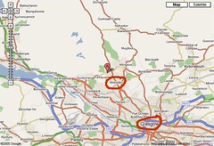
so beautiful & green =)
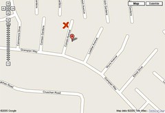
Culvain Avenue:
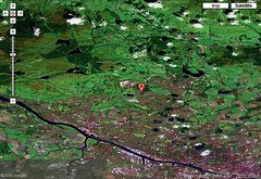
26 years from now, highly doubt that I can still locate anything familiar in Singapore? sense of belonging isn't something that can be located using maps & satellite images ;)
************
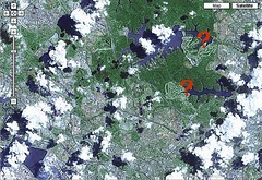
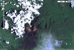
Central Catchment Reserve, Singapore:
zoom in, & e parts that have been scarred by golf courses (marked by '?' in red) become glaringly obvious. looks as if something sharp was used to scratch off e greenery:
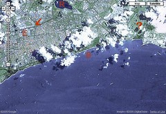
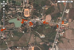
east coast of Singapore (E = Eunos Industrial Estate? arrow = where Jalan Eunos meets PIE? R = Bedok Reservoir? J = Bedok Jetty?), with ships in e Eastern Anchorage & yet another golf course:
************
on a whim, tried hunting for familiar spots, & managed to find e cuspate delta that was spotted while skirting e northern coastline of Borneo on a Senai - Kota Kinabalu Air Asia flight:
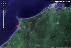
think it is e delta of Sungei Baram (B), with Miri (M) on e left of e river & Brunei somewhere on e right?
one of e easiest features to locate - Gunung Kinabalu with e deep cleft of Low's Gully (L) separating e Western & Eastern summit plateaux (spelling?):
Tanjung Chek Jawa + part of Pulau Tekong:
Mae Yao subdistrict on e northern bank of e Kok river (T - now why did I type 'T' instead of 'K'? thinking of Tha Ton which is upriver?):
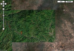
route to Naga Hill:
tree-lined road leading to Chiang Rai Rajabhat University (CRU) campus on right. 1 = bus/songthaew stop where I watched traffic cops cracking down on motorcyclists without crash helmets, before encountering that songthaew driver who kept asking if I had a saamii or fen (husband or boyfriend), 2 = bus/songthaew stop on other side of overhead bridge along e Asia Superhighway where green songthaews heading into Chieng Rai city pass by, 3 = shops selling food & university uniforms, & their version of Queensway Ultra Supplies for 'replicating books' ;) N = Naga Hill resort.
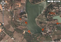
maps.google.com continues to amaze....Naga Hill resort:
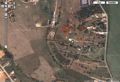
C = shed where cows are kept, P = pond, B = bungalows hidden beneath plenty of trees, S = swimming pool, R = restaurant, arrow = direction to look out from e restaurant towards Mae Yao for a view of e hills & mountains
back in Chieng Rai city center:
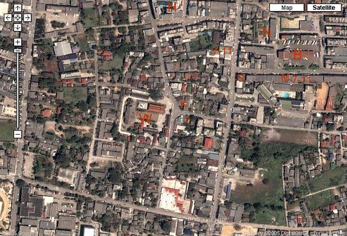
W = Wat Jet Yod....building on left of 'W' is e monks' quarters, on top of e 'W' is e 7-spired (Jet Yod) chedi (white) & main hall with e Buddha image (orange roof) & big fat bodhi tree. K & J = Korean & Japanese restaurants, S = Thai silk shop, M = Chinese medicine hall that had plenty of interesting herbs & plant parts, 7-11s = where I fed my green tea milk addiction, H = Wang Come Hotel?, B = Chieng Rai bus station, N = Chieng Rai night bazaar =)
[ filed under: nature1 ]


No comments:
Post a Comment